Dunmore Beach
A sweeping Loyalist-era beach where plantation history meets pristine Caribbean shore
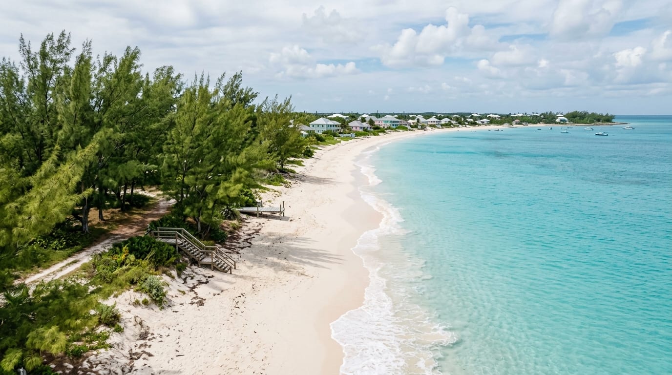
Named for John Murray, 4th Earl of Dunmore, the Scottish nobleman who served as Governor of The Bahamas from 1786 to 1797, Dunmore Beach stretches along the Caribbean coast of Long Island near the settlement that also bears his name. This mile-long strand of soft white sand and crystal-clear turquoise water carries echoes of the plantation era when Lord Dunmore established cotton estates worked by the enslaved people he brought from Virginia and New York.
Today, Dunmore Beach offers visitors one of Long Island's most beautiful and accessible Caribbean-side beaches. The gentle waters and soft sand make for excellent swimming, while the historical context adds depth to the experience. Plantation ruins dot the interior nearby, silent witnesses to a transformative and troubled chapter in Bahamian history.
Lord Dunmore's Legacy
Before arriving in The Bahamas, Lord Dunmore served as royal governor of New York and later Virginia, where he notoriously offered freedom to enslaved people who fled Patriot masters to join the British cause. His time in The Bahamas saw the establishment of plantations worked by the enslaved people he brought with him, their numbers dramatically increasing the islands' population. The settlement named for him represents this complex colonial inheritance, where the descendants of both governor and enslaved now share the community.
The Beach Today
Dunmore Beach offers approximately one mile of fine white sand facing the calm Caribbean waters. The beach is naturally shaded in sections by casuarina pines and sea grape trees, providing relief from the tropical sun. Swimming conditions are typically excellent, with gradual depths and minimal currents. The remote location means crowds are virtually unknown, though local families may visit on weekends. Bring all supplies as there are no facilities.
Exploring the Ruins
The area around Dunmore Settlement contains ruins from the plantation era, including remnants of estate houses and processing facilities. These crumbling stone structures stand amid reclaiming vegetation, offering sombre reminders of the cotton plantation economy that briefly flourished before exhausted soils ended the enterprise. Walking among the ruins connects visitors to this difficult history in tangible ways that museums cannot replicate.
Getting there
Dunmore Beach is located at Dunmore Settlement on Long Island, accessible via Queen's Highway. From Clarence Town, drive north; from Stella Maris, drive south. The settlement is clearly marked, and local roads lead to beach access points. A rental car is essential as there is no public transportation. The beach is undeveloped with no facilities, so bring food, water, sunscreen, and any needed equipment. Respect private property when accessing the beach.
Frequently asked questions
- Can I visit the plantation ruins?
- The plantation ruins are scattered around Dunmore Settlement, some on private land and others accessible from public roads. Explore respectfully and do not enter fenced areas. The ruins are not maintained as tourist sites, so exercise caution around unstable structures and uneven ground.
- Is there snorkeling at Dunmore Beach?
- Snorkeling is possible though the beach area is primarily sandy bottom. Better snorkeling can be found at reef areas elsewhere on Long Island. The calm, clear water does allow for pleasant viewing of sand-dwelling creatures and occasional reef fish that wander into the shallows.
- How does Dunmore Beach compare to Cape Santa Maria?
- Cape Santa Maria is often considered the most spectacular beach on Long Island and draws more visitors despite its remote location. Dunmore Beach is less famous but equally beautiful in its own way, and its historical context adds an educational dimension. Both are excellent choices for a beach day.